
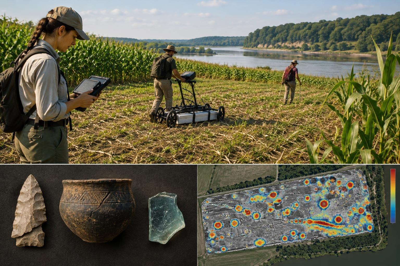
What can a patch of soil remember after its houses, meals and makers have vanished? Near New Ulm, Minnesota, archaeologists have found a way to read some of those traces without first digging them up: by measuring tiny variations in the ground’s magnetic properties.
The clues lie in a fallow cornfield beside the Mnísota Wakpá, or Minnesota River. Its surface has been disturbed by plowing, while erosion has been eating into the riverbank. Yet below the churned soil, researchers found evidence of buried features that may preserve details of everyday life across centuries.
A landscape with more than one past
The site’s known artifacts span an extraordinary stretch of time. More than 10,000 years ago, someone left a finely worked but broken stone spearpoint on an island emerging from glacial floodwaters. Around 1300 C.E., an Ancestral Dakota woman made a decorated ceramic pot for cooking corn grown in the river bottomlands. In the early 19th century, a Dakota person reshaped a piece of a trade-era glass bottle into a cutting edge using an ancestral stone-tool technique.
These objects are glimpses, not complete biographies. An artifact found at a site does not by itself reveal exactly who used it or what happened around it. Archaeologists need its context: the layer of soil, feature or collection of remains in which it was found. That context can be lost when fields are plowed—or when riverbanks collapse.
The team’s question was therefore not simply what objects had surfaced, but whether deeper, less disturbed traces remained. Storage pits and hearths can act like buried time capsules, holding scraps of food, ash and other household debris that help researchers interpret a site’s surface finds.
Reading what the soil does to a compass
Archaeologists from the Science Museum of Minnesota worked with the firm Archaeo-Physics to survey the ground without excavating it. They began with LiDAR, which uses laser measurements to map the land’s surface, then used electromagnetic induction to scan a broad area for soils whose magnetic properties might have been changed by human activity.
That change can have surprisingly ordinary origins. Food preparation, hide processing and other daily work leave organic waste in the soil. As microbes act on that material, they can help form magnetite, a strongly magnetic iron mineral. Areas altered by human activity may therefore register differently from the surrounding natural soil.
Those broad scans helped the team choose smaller areas for closer examination. Ground-penetrating radar can reveal buried boundaries, but fine silt at this site weakened its signal. A magnetic survey proved more useful: it detected subtle variations in the Earth’s magnetic field, including contrasts between soils with different magnetic properties.
Not every magnetic signal means the same thing. Fired pottery, some rocks and iron objects can produce strong, distinctive responses; archaeologists also look for weaker signals that may point to burned or organically enriched soil. The skill lies in interpreting those patterns cautiously, rather than treating every mark on a map as a discovered object.
Testing the map against the ground
Working through heavy vegetation during a heatwave, the researchers collected about 650,000 readings across an area measuring 250 by 100 metres. The resulting map showed dozens of circular anomalies, each roughly one to two metres across. These were possible buried features, not proof of what lay beneath them.
To check their interpretation, the team took narrow soil cores from two anomalies and from nearby control spots. The anomaly cores contained dark, ash-speckled soil with traces of shell more than a metre below the surface. The control cores, by contrast, reached light-brown, apparently undisturbed subsoil below the plow zone. Measurements down the core holes also showed elevated magnetic susceptibility deep within the suspected features.
This is strong support for the idea that the magnetic map had identified buried pits. But the survey has not established what every anomaly contains, or dated the two tested features. The museum’s archaeologists recommended one, labelled Anomaly B, for further testing; results are still to come.
The discovery’s quiet significance is that archaeology can begin with a question asked of the soil, not a trench cut into it. Magnetic measurements cannot tell the whole story, but they can help locate the places where that story may still be intact. Beneath a field repeatedly turned by farming, the past has not disappeared so much as become difficult to see—and, sometimes, it leaves a signal.